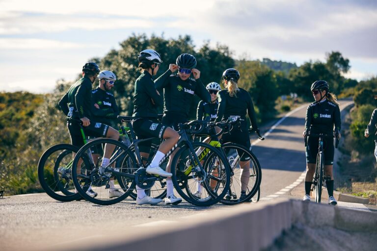
Planning a safe and efficient bike commute route comes down to three core steps: mapping multiple route options using cycling-specific apps or local bike maps, test-riding your top choices during non-peak hours, and then refining based on real conditions like traffic patterns, road surface quality, and available cycling infrastructure. The fastest route by distance is rarely the best route by experience””a path that adds half a mile but uses protected bike lanes or quiet residential streets will often get you to work faster, calmer, and with a much lower risk of conflict with motor vehicles. Consider a commuter traveling from a residential neighborhood to a downtown office five miles away. The direct route along a major arterial road might look efficient on a standard map, but that same corridor could feature heavy truck traffic, no shoulder, and poorly timed traffic signals.
An alternative route using a parallel greenway trail for three miles, then connecting via low-traffic side streets, might add seven minutes to the theoretical travel time but eliminate nearly all interactions with high-speed traffic. This article covers how to identify these alternatives, what tools and resources help you evaluate them, and how to adapt your route as seasons, construction, and your own fitness levels change. Beyond the initial planning phase, successful bike commuting requires ongoing adjustment. You will learn how to read infrastructure for safety cues, balance speed against stress, prepare for weather and seasonal shifts, and troubleshoot common problems that derail even well-planned routes.
Table of Contents
- What Makes a Bike Commute Route Both Safe and Fast?
- Using Mapping Tools and Local Resources to Find Cycling Routes
- Test Riding Your Route Before Committing
- Balancing Distance, Elevation, and Infrastructure Quality
- Adapting Your Route for Weather and Seasons
- Handling Intersections and High-Conflict Zones
- Incorporating Backup Routes and Flexibility
- Long-Term Route Refinement and Reassessment
- Conclusion
What Makes a Bike Commute Route Both Safe and Fast?
The tension between safety and speed is often overstated. In urban and suburban environments, routes that feel dangerous””riding alongside fast-moving traffic, navigating complex intersections, dealing with door zones from parked cars””also tend to be slower in practice. Stress causes hesitation, unpredictable driver behavior forces sudden stops, and the mental load of constant vigilance wears you down over a multi-mile commute. Routes designed around cycling infrastructure, predictable traffic patterns, and good sight lines tend to deliver both safety and reasonable speed. That said, there are genuine tradeoffs. A fully separated multi-use path might be the safest option, but if it is crowded with pedestrians, dog walkers, and recreational cyclists, your average speed could drop significantly compared to a well-maintained road with a painted bike lane and light traffic.
Similarly, a route that avoids all hills might add so much distance that the time cost outweighs the energy savings. The goal is not to eliminate all risk or maximize pure speed, but to find your personal balance point””one that gets you to work feeling capable and alert rather than exhausted or rattled. Evaluating a route requires thinking beyond the map. Road surface matters: a smooth bike path beats a potholed shoulder every time. Signal timing matters: some corridors are timed for car speeds that leave cyclists stuck at every red light. Visibility matters: routes with good sight lines at intersections reduce the chance of right-hook collisions. These factors rarely show up in standard mapping applications, which is why test rides and local knowledge are irreplaceable.

Using Mapping Tools and Local Resources to Find Cycling Routes
cycling-specific mapping tools have improved substantially in recent years. Apps like Komoot, Ride with GPS, and Strava’s route builder pull from user data to suggest roads and paths that cyclists actually use and rate highly. Google Maps offers a cycling layer that shows bike lanes and trails, though its routing algorithm sometimes suggests roads that look bikeable on paper but feel hostile in reality. Apple Maps has added cycling directions in many cities, with elevation profiles and surface type indicators. However, no app perfectly captures current conditions””construction, seasonal closures, or newly installed infrastructure may not be reflected. Local resources often outperform national apps for route planning.
Many cities and counties publish official bike maps, either in print or as downloadable PDFs, that show not just where bike lanes exist but also their type””protected, buffered, standard, or sharrow. These maps sometimes include recommended routes developed by transportation planners who have actually ridden the corridors. Regional cycling advocacy organizations frequently maintain route guides, and online forums or social media groups for local cyclists can provide candid assessments of specific roads and intersections. One limitation of relying solely on digital tools is that they cannot convey the feel of a route. A road rated as “bike-friendly” might technically have a bike lane, but if that lane runs alongside parked cars with frequent door openings, or if it disappears unpredictably at intersections, the experience will not match the map. This is why initial route planning should be treated as hypothesis generation, not final decision-making.
Test Riding Your Route Before Committing
Before relying on any route for daily commuting, ride it at least twice: once during a low-stress time like a weekend morning, and once during conditions that match your actual commute. Traffic patterns at 7:30 AM on a Tuesday differ dramatically from those at 10 AM on a Saturday. School zones, delivery trucks, garbage collection schedules, and rush-hour congestion all affect how a route performs. A street that feels pleasant and empty on Sunday might be a high-stress gauntlet during Monday morning rush. During test rides, pay attention to specific hazards. Note intersections where sight lines are poor or where turning vehicles create conflict points. Identify stretches where you would be riding in the door zone of parked cars.
Look for sections where the road surface deteriorates””cracked pavement, drainage grates oriented parallel to your direction of travel, or gravel accumulation on shoulders. Watch how drivers behave: some roads have an established culture of yielding to cyclists, while others seem to encourage aggressive passing. These observations are difficult to quantify but essential to your final decision. If your initial route proves problematic, do not assume the entire commute is unworkable. Often, a single dangerous intersection or uncomfortable half-mile stretch is the weak link. Look for alternatives that bypass just that section. A one-block detour to avoid a poorly designed intersection can transform an otherwise stressful commute into a manageable one.

Balancing Distance, Elevation, and Infrastructure Quality
Route planning involves tradeoffs among distance, elevation gain, and infrastructure quality, and the right balance depends on your fitness, your bike, and your tolerance for various types of stress. A hillier route with good bike lanes might be preferable to a flat route along a high-speed road with no shoulder. Conversely, a cyclist on a heavy bike with limited gearing might reasonably prioritize flat terrain even at the cost of some infrastructure quality. Consider the comparison between two hypothetical routes to the same destination. Route A is 4.5 miles with 150 feet of climbing, mostly on roads with painted bike lanes and moderate traffic. Route B is 5.8 miles with only 40 feet of climbing, using a combination of multi-use trails and quiet residential streets with no dedicated cycling infrastructure.
For a fit cyclist on a light road bike, Route A might take 20 minutes and feel manageable. For a commuter on a heavier bike carrying a laptop and change of clothes, Route B’s extra distance might be offset by the lower physical intensity and reduced traffic stress, arriving in roughly the same time but with energy to spare. Elevation deserves particular attention because its impact is asymmetric. Climbing a hill takes significant time and energy; descending takes very little time but introduces speed-related risks. A route with a long climb at the start and a descent at the end means arriving at work having done the hard work while fresh, then enjoying an easy finish to the ride home. The reverse””easy ride in, hard climb going home””might leave you dreading the evening commute after a tiring workday.
Adapting Your Route for Weather and Seasons
A route that works well in dry summer conditions may become problematic in winter or during rainy seasons. Painted bike lanes offer no physical protection and become slippery when wet. Multi-use paths through parks may not be plowed or salted in winter. Low-lying routes can flood or accumulate debris after storms. Effective year-round bike commuting often requires maintaining two or three route variations for different conditions.
One common adaptation is shifting from off-road paths to on-road routes during winter. While this might seem counterintuitive””roads have cars, after all””roads are more likely to be cleared of snow and ice than recreational paths. A cyclist in a northern climate might use a riverside trail from April through October, then switch to a parallel arterial road with a bike lane from November through March, accepting increased traffic exposure in exchange for predictable surface conditions. However, if your area experiences extended periods of ice, heavy snow, or persistent rain, some routes may simply become unridable regardless of adaptation. This is a real limitation of bike commuting in certain climates and should factor into your overall planning. Having a backup transportation plan””whether public transit, carpooling, or driving””for genuinely dangerous weather days is not a failure of commitment but a reasonable safety practice.
Handling Intersections and High-Conflict Zones
Intersections account for a disproportionate share of cycling crashes, and evaluating intersection quality should be central to route planning. The most dangerous intersection types for cyclists include those where bike lanes end abruptly, where right-turning vehicles cross the bike lane, and where multiple lanes of traffic merge or diverge. Routes that minimize exposure to complex, high-volume intersections are inherently safer, even if they add distance. Specific intersection designs to watch for include right-turn-only lanes that cyclists must cross, slip lanes that encourage high-speed turns, and intersections where the bike lane is positioned between a right-turn lane and a through lane. These configurations create conflict points where drivers may not see or yield to cyclists.
If your route includes such intersections, consider whether alternative crossings exist””perhaps a block earlier or later””or whether the timing of your commute allows you to cross during lower-traffic periods. For unavoidable difficult intersections, develop a consistent strategy. Some cyclists prefer to take the lane assertively, ensuring visibility. Others prefer to use pedestrian crossings when signal timing permits. Neither approach is universally superior; the right choice depends on intersection geometry, traffic volume, and your own comfort level. What matters is having a plan rather than improvising differently each day.
Incorporating Backup Routes and Flexibility
Even the best-planned primary route will occasionally be blocked by construction, accidents, special events, or infrastructure failures. Building familiarity with one or two alternative routes prevents these disruptions from derailing your commute. Ideally, your backup routes should use different major roads or paths, so that a problem on one corridor does not affect the other. For example, a commuter whose primary route follows a popular bike trail might develop a backup using residential streets parallel to the trail. If the trail is closed for maintenance or flooding, the street route is immediately available without requiring on-the-spot navigation through unfamiliar territory.
The backup need not be as optimal as the primary route””it just needs to be safe and known. Real-time information sources can help you switch routes proactively. Some transit agencies and municipal transportation departments post alerts about major construction or road closures. Local cycling social media groups often share reports of unexpected hazards. Checking these sources before leaving, especially during seasons when road work is common, can save you from discovering a closure mid-commute.
Long-Term Route Refinement and Reassessment
Your optimal route will change over time, and periodic reassessment prevents stagnation. New infrastructure gets built: a protected bike lane opens, a trail connection is completed, a dangerous intersection gets redesigned. Your own fitness and confidence change: hills that once seemed daunting become manageable, and you may become comfortable on roads that previously felt intimidating.
The surrounding environment changes: a new office building increases pedestrian traffic on a shared path, or a business closure reduces delivery truck activity on a side street. Set a reminder to consciously reevaluate your route every six months or whenever you notice consistent frustrations. This does not mean abandoning a working route, but rather asking whether the assumptions that led you to choose it still hold. Cycling infrastructure is expanding in many cities, and routes that were impossible or unpleasant a few years ago may now be viable.
Conclusion
Planning a bike commute route that balances safety and speed requires more than drawing a line on a map. It involves understanding your local infrastructure, testing routes under realistic conditions, and making informed tradeoffs among distance, elevation, and traffic exposure. The best route is rarely the shortest or the flattest””it is the one that gets you to work consistently, with manageable stress and acceptable risk. Start by generating candidate routes using cycling-specific tools and local resources, then test-ride your top options during actual commute hours.
Pay attention to intersections, road surfaces, and traffic behavior. Build backup routes and adapt for seasonal conditions. Revisit your choices periodically as infrastructure and your own capabilities evolve. With deliberate planning and ongoing refinement, bike commuting can become a reliable, even enjoyable, part of your daily routine.